Product Overview
It is a scene and grid-based three-dimensional prevention and control system built on the Internet of Things, augmented reality, smart analysis, GIS, big data and software integration, and other advanced technologies. By taking the high spot video in key areas of the cities as the carrier, and using augmented perception, convergence of isomerous data, measurement and calculation of space coordinates, joint equipment telecommunication, interactive encapsulation of tags, integrated demonstration of interface, and other means, it develops the effect of video live-action map, and realizes the prevention, control, command and combat businesses in multiple grids and key areas of the cities under an integrated portal. Regarding video information, it can ensure the grasping of the general conditions at the high spot and look at the details at the low point; as for data information, it can realize the convergence and demonstration of multi-source data, and the integration and call of the business system. In so doing, it addresses the information integration and coordination issue in multiple application scenes of the cities/regions in terms of public security maintaining, anti-terrorism, emergency command, grid governance and the like with a visualized and convenient experience.
Technical Features
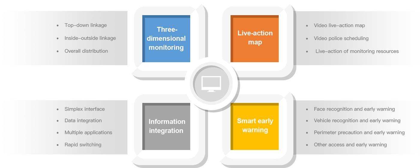
Functions & Peculiarities
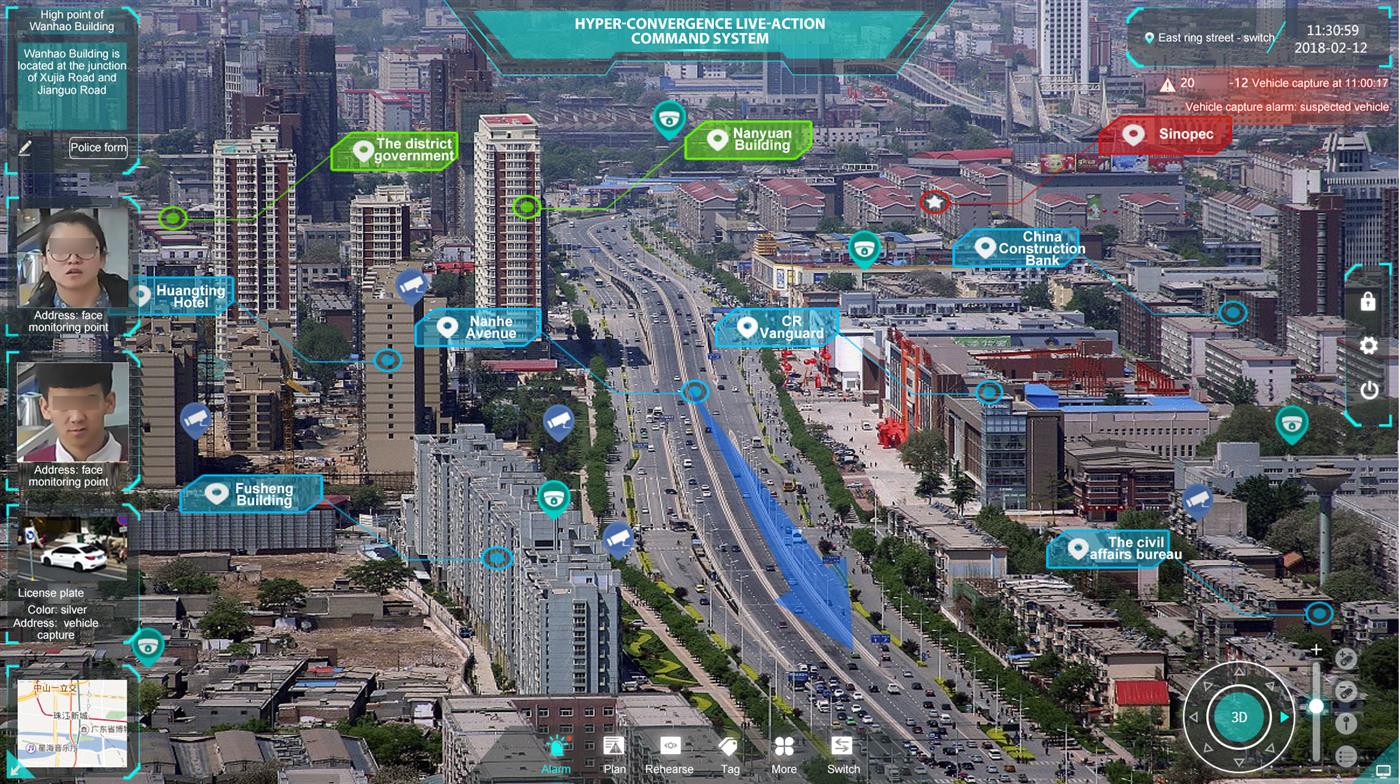
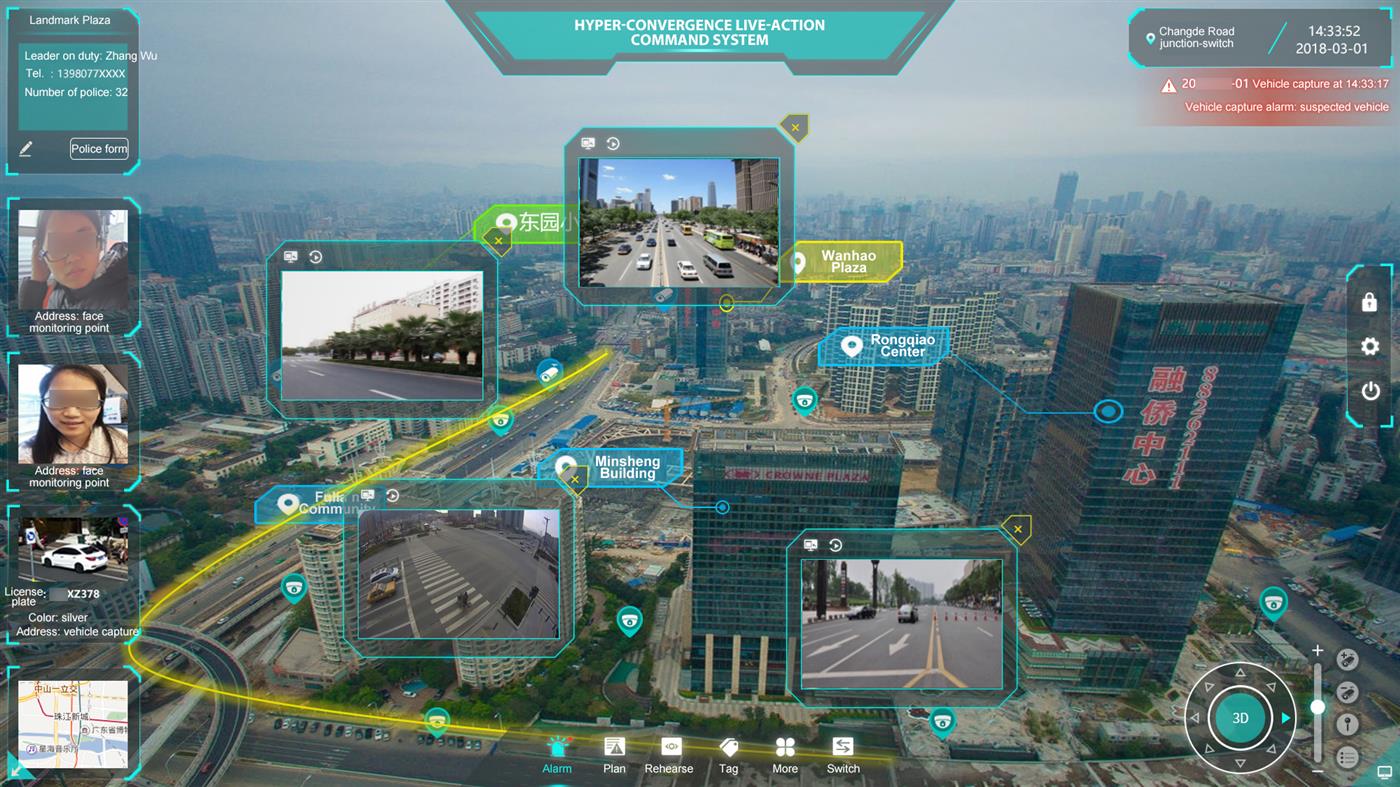
Video live-action map
By taking high spot video frame with high coverage and large-scale scene as the carrier, the system overlays the roads, buildings, key targets, monitoring resources, police resources and the like within the high spot coverage in the form of tags by augmented reality technology. The tags support searching, positioning, and have the properties of hierarchy and classification. In this way, the video live-action map is formed on the whole.
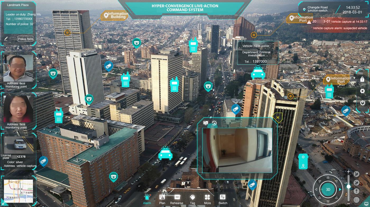
Three-dimensional monitoring
The system masters and monitors the general security situation in the region by overlooking the ground from the high spot. It can look at various low point control resources in the form of picture-in-picture in the high spot global screen by connecting with low point video, human face monitory gateway, vehicle monitory gateway and others through tag linkage technology. The high and low levels are coordinated, thus establishing a three-dimensional prevention and control regime from high to low and from inside to outside points.
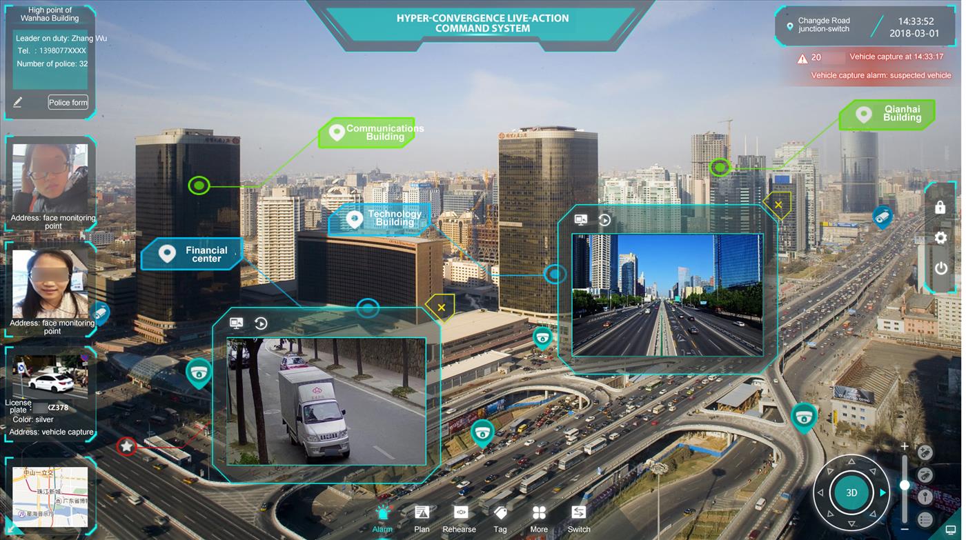
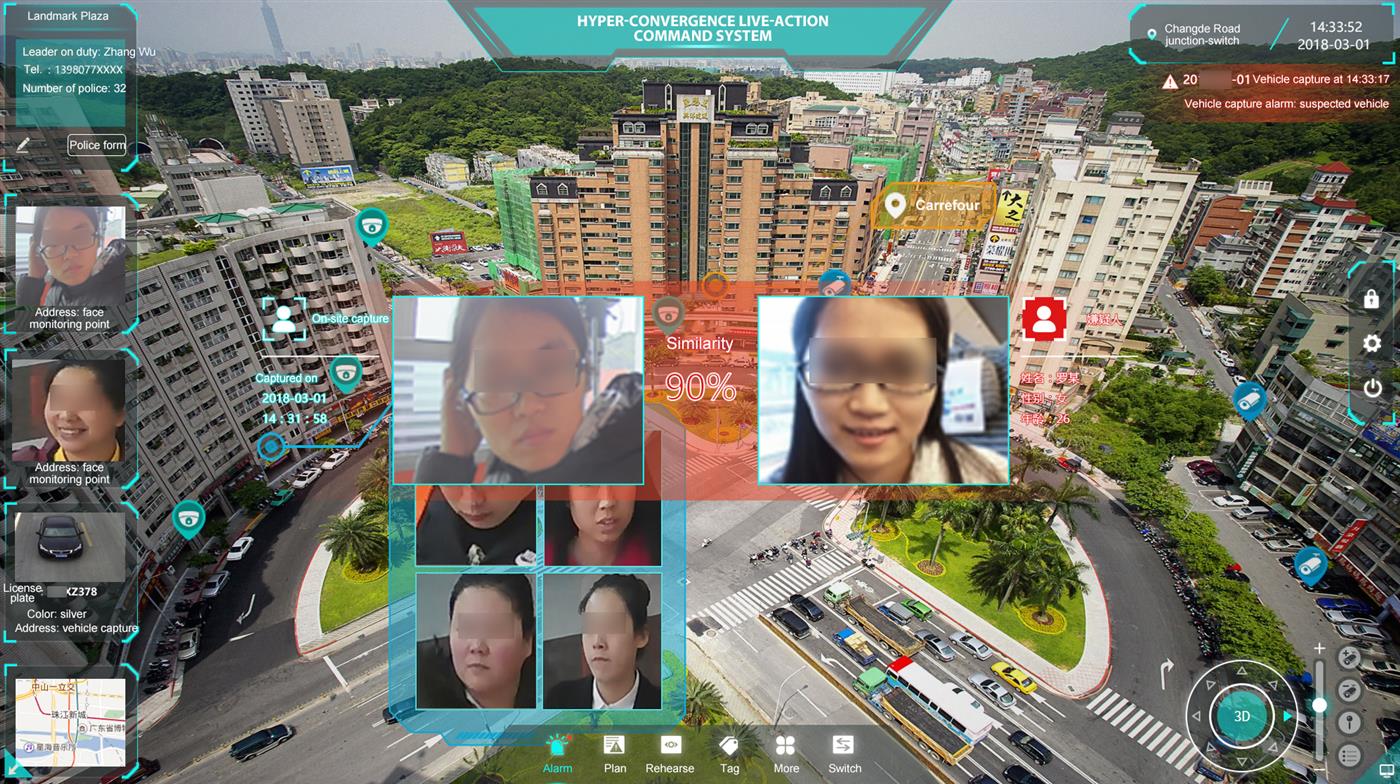
Smart early warning
The system can connect the alarm information generated from human face monitory gateway, vehicle monitory gateway, perimeter precaution and the like, demonstrate the same in high spot picture, and connect with high and low point cameras surrounding the alarm point and turn them to the alarm point to look at the scene. This can realize a very convenient and smart response to the alarm event, and reduce the workload of the monitoring staff.
Live-action police scheduling
The system overturns the police scheduling mode of traditional 2D map, transforms GPS coordinates to video coordinates by connecting with 4G law enforcement instrument, 4G image transmission vehicle, 350M and others, and can reflect the current position of police force and paddy wagon in the video frame on a real time basis, thus facilitating the visualized police scheduling by the command crew.
Automatic POI tag
Via the POI downloading and import facility, the system can download the POI information on the Baidu Map, Amap and PGIS map of the public security network, import the downloaded POI information, automatically generate the POI tag in high spot image, and enrich the tag demonstration information in high spot image.
.jpg)
Guard line security
The system can set up the cruise path of high spot camera based on the guard line during the daily video patrol and security for important activities. It can also automatically retrieve the low point video on various monitored points on the guard line during the patrol process, look at the road details of the guard line, and provide guard line security in an automatic and process-based manner.
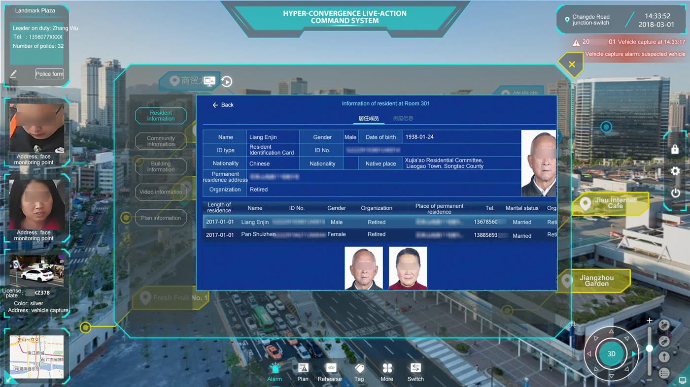
Grid-based management
The system can launch grid-based management on community, bar, KTV and other places within the high spot coverage, realize the live-action appearance of various housing data, population data and unit data of the comprehensive governance of public security through tag-associated video, audio, image, text and other information, thus facilitating the precise grid management.
Data business integration
By getting through the interface with third-party system, the system demonstrates and operates all data related to command and dispatch in high spot image in a visualized way through augmented dynamic reality tag and floating animation, realizes the operation of all businesses under a unified portal, and greatly improves the work efficiency of the command officer.
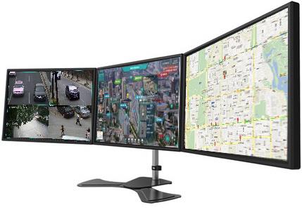
Three screens of one computer
Main screen: demonstrates the main interface of the hyper-convergence live-action command system
Map screen: can grasp the general distribution of high spot resources and low point control resources from a macro sense
Linkage screen: displays the video of key places, and supports the divided carousel of 4-frames and 9-frames